Downeast Fisheries Trail . Skills included photo research and retouching, map rendering, photography, and vendor relations (panel manufacturer).
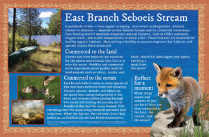
Mattamiscontis signage project located in Penobscot off-reservation trust land. Maine Sea Grant partner was the Penobscot Indian Nation
Mattamiscontis signage project located in Penobscot off-reservation trust land. Maine Sea Grant partner was the Penobscot Indian Nation
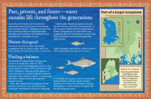
Maine Coast Heritage Trust interpretive signage; Brooksville, Maine
Maine Coast Heritage Trust interpretive signage; Brooksville, Maine
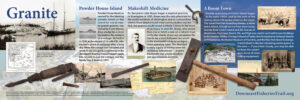
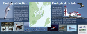
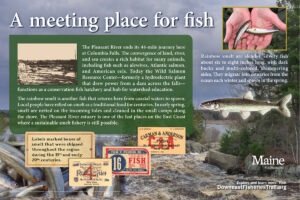
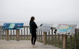
Downeast Fisheries Trail interpretive signage at Maine Center for Coastal Fisheries’s site in Stonington, Maine.
Downeast Fisheries Trail interpretive signage at Maine Center for Coastal Fisheries’s site in Stonington, Maine.
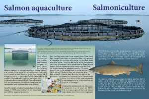
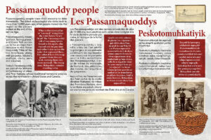
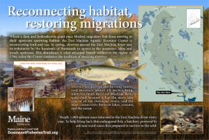
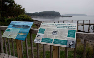
Downeast Fisheries Trail interpretive signage at Roosevelt Campobello International Park on Campobello Island, New Brunswick, Canada
Downeast Fisheries Trail interpretive signage at Roosevelt Campobello International Park on Campobello Island, New Brunswick, Canada
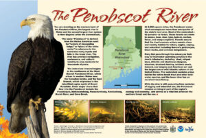
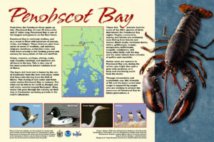
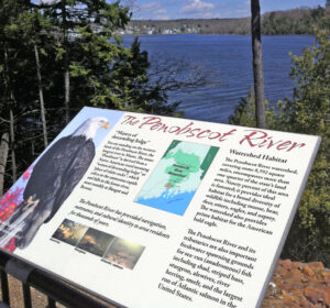
Penobscot Narrows Bridge and Observatory
Penobscot Narrows Bridge and Observatory
Downeast Fisheries Trail interpretive signage at Maine Center for Coastal Fisheries’s site in Stonington, Maine.
Downeast Fisheries Trail interpretive signage at Maine Center for Coastal Fisheries’s site in Stonington, Maine.
Downeast Fisheries Trail interpretive signage at Roosevelt Campobello International Park on Campobello Island, New Brunswick, Canada
Downeast Fisheries Trail interpretive signage at Roosevelt Campobello International Park on Campobello Island, New Brunswick, Canada
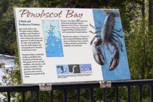
Penobscot Narrows Bridge and Observatory (Revised by newer organization)
Penobscot Narrows Bridge and Observatory (Revised by newer organization)